
Across industries like AEC & Infrastructure, mining and aggregates, and land surveying, LiDAR has become the gold standard for precision mapping. From topographic mapping and stockpile volume calculation to progress monitoring and as-built documentation, enterprises rely on accurate geospatial data to plan, build, and manage critical assets.
Too often, workflows are designed around a single tool. Fixed-wing LiDAR delivers unmatched efficiency over large corridors, while handheld systems capture millimeter-level detail in tight spaces. Choosing one or the other forces trade-offs — either blind spots, slower workflows, or costly re-visits.
The most effective enterprises don’t choose. They combine. Here we’ll explore how fixed-wing and handheld LiDAR can complement each other, why complete coverage is critical, and how survey firms are delivering more accurate 3D point clouds, orthomosaic surveys, and Digital Twins through integrated workflows.
The Enterprise Data Challenge
Project requirements across AEC, mining, and surveying are evolving. Clients expect high-accuracy deliverables like DEM/DSM/DTM (Digital Elevation, Surface, and Terrain Models), contour lines, 3D reconstruction, and survey-grade precision, delivered faster than ever.
The cost of incomplete data is steep:
- Missed bridge clearances mean repeat site visits.
- Gaps in canopy coverage disrupt bare-earth model (DEM) generation.
- Limited accuracy can delay cut-and-fill analysis, volume calculation, or BIM/VDC (Building Information Modeling / Virtual Design Construction) integration.
Traditional methods like photogrammetry or total stations may capture detail but not speed. Conversely, UAV flights alone can produce orthophotos but miss obstructed structures. Progressive organizations need workflows that combine efficiency and detail to deliver complete, client-ready datasets.
The Fixed-Wing Advantage
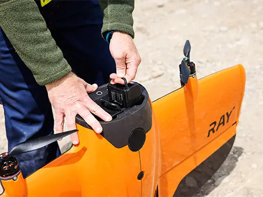
Fixed-wing LiDAR platforms like the WingtraRay are purpose-built for scale. Equipped with modern sensors, they capture high-density 3D point clouds at survey-grade accuracy over vast areas.
Where fixed-wing LiDAR excels:
- Corridor Mapping – Highways, railways, and pipeline corridor mapping.
- Large-Area Topographic Mapping – Regional planning, watershed modeling, and floodplain mapping.
- Forestry and Vegetation Analysis – Estimating biomass, canopy height, and building bare-earth models (DEM).
- Mining & Aggregates – Stockpile inventory, terrain modeling, pit mapping, and slope stability analysis.
Strengths include:
- Covering hundreds of square acres in a single flight.
- Generating contour mapping and orthomosaic surveys.
- Penetrating vegetation for accurate bare-earth DEMs.
- Delivering survey-grade vertical accuracy (±5–10 cm).
Limitations? Mobilization costs, weather restrictions, and difficulty capturing tight or obstructed spaces. Fixed-wing platforms provide coverage and speed but not close-range precision.
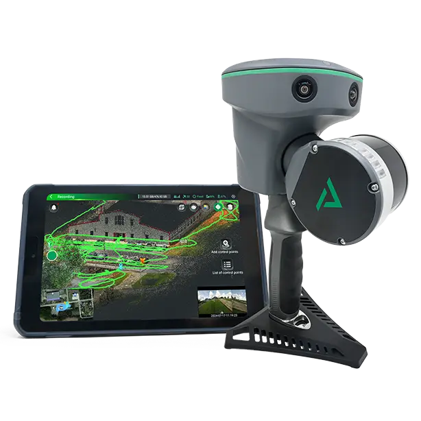
Where Handheld LiDAR Wins
Handheld LiDAR systems, like the TrueView Go, shine where fixed-wing platforms cannot operate. These portable solutions capture millimeter-level resolution scans in GNSS-denied environments such as tunnels, interiors, and dense canopy.
Key use cases:
- Bridge and Structure Mapping – Detailed scans for as-built documentation and CAD/GIS integration.
- Industrial & AEC Applications – Quick progress monitoring and VDC workflows.
- Construction Sites – Planimetric mapping of utilities, retaining walls, and foundations.
- Heritage & Archaeology – High-fidelity 3D reconstruction of historical structures.
- Vegetation & Canopy Gaps – Capturing features blocked from aerial line-of-sight.
Strengths include:
- Portability
- Low Operational Costs
- Ability to produce survey-grade elevation models and Digital Assets, such as as-built documentation or Digital Twins.
The limitation? Coverage. Handheld LiDAR scans tens of meters at a time, making them labor-intensive for corridor-scale projects.
Why Workflows Need Both
Fixed-wing LiDAR delivers coverage. Handheld LiDAR delivers detail. When combined, companies eliminate the trade-offs and achieve complete Reality Capture workflows.
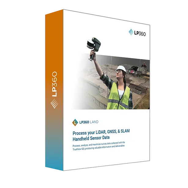
Software like LP360 merges datasets from both platforms into unified deliverables, producing 3D point clouds, orthomosaics, and contour lines that integrate seamlessly with CAD/GIS and BIM systems.
The business case:
- Lower Costs – Fewer crews and less field time cut labor in half.
- Faster Delivery – Projects completed up to 70% faster.
- Higher Accuracy – Survey-grade, centimeter-level precision across entire sites.
- Scalability – Firms double annual capacity without increasing headcount.
Enterprises that embrace this approach don’t just deliver data — they deliver confidence.
Case Study: Surveying 120 Miles of Highway
A mid-sized survey firm specializing in transportation and infrastructure mapping won a State DOT contract to survey 120 miles of rural highway with 20 bridges and dense canopy.
Traditional workflows would take 8–10 weeks with multiple crews, high costs, and safety risks. Instead, the firm deployed a combined LiDAR workflow:
- WingtraRay with LiDAR captured 30–40 miles of corridor per day, delivering a 3D point cloud and digital surface model (DSM) of the alignment in four days.
- TrueView Go Handheld LiDAR scanned bridges, culverts, and canopy gaps, generating millimeter-accurate as-built documentation in five days.
- LP360 Software merged datasets into a unified deliverable for the DOT, including orthophotos, contour lines, and georeferenced elevation models.
Results:
- 70% faster project completion.
- 50% lower labor costs.
- 90% fewer return trips.
- ±5 mm bridge accuracy — a fivefold improvement.
- Deliverables reduced from 12–14 weeks to just five.
- ROI in under a year.
This workflow expanded the firm’s annual project capacity from 6–7 projects to 12–14, allowing them to take on more high-value contracts across surveying & mapping, aggregates, and AEC infrastructure projects.
The UVT Difference
At UVT, we don’t sell hardware in isolation. We design workflows. That means bringing together fixed-wing, quadcopter, and handheld LiDAR systems, along with post-processing tools like LP360, to deliver end-to-end enterprise solutions.
Our portfolio includes:
- Inspired Flight IF800/IF1200 + TrueView – NDAA-compliant heavy-lift options for survey-grade 3D point clouds.
- Freefly Astro + TrueView – Lightweight, scalable mapping platform for DEM/DSM/DTM creation.
- WingtraRay – Corridor-scale efficiency for pipeline right-of-way (ROW) monitoring, transmission line mapping, and terrain modeling.
- TrueView Go Handheld – Portable Reality Capture for bridges, interiors, and as-built documentation.
- LP360 Software – Universal compatibility for merging datasets into Digital Twins and orthomosaic surveys.
We also support enterprises with flexible financing through First Western to make investments in LiDAR accessible while ensuring teams stay Always On.
Closing
Complete coverage is no longer a competitive edge — it’s the expectation. Whether it’s cut-and-fill analysis for aggregates, pipeline corridor mapping for oil and gas, or as-built documentation for AEC firms, enterprises cannot afford blind spots.
By combining fixed-wing and handheld LiDAR, survey teams deliver survey-grade, centimeter-precision datasets the first time — with no re-visits, no costly delays, and no missed details.
Our team partners with enterprises to consult, design, and deploy these workflows. From hardware and software to training and financing, our mission is to keep your teams Always On.
Let’s talk about how UVT can build your enterprise LiDAR program.