Smart. Safe. Secure.
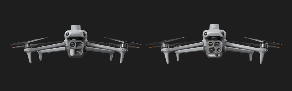
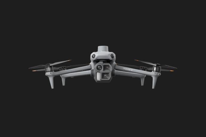
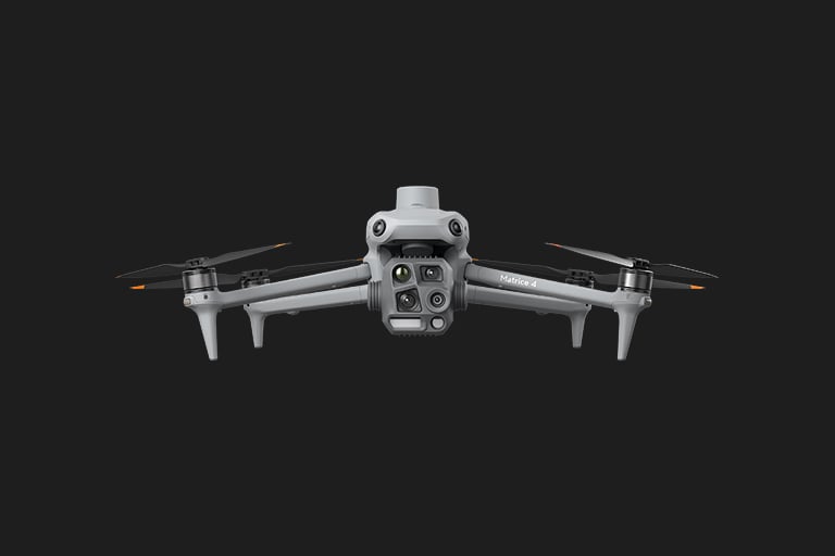
The DJI Matrice 4 Series—featuring the Matrice 4T and Matrice 4E—delivers AI-powered precision, advanced sensors, and unmatched reliability. Built for the demand of professionals, the DJI M4 sets a new standard for enterprise sUAS operations.
Whether it’s, Security, Public Safety, Inspections, Mapping, or Overwatch, the Matrice 4 Series is designed for the most demanding missions.

AES-256 Encryption
Video is transmitted with AES-256 encryption providing a reliable, secure signal.

Local Data Mode
Prevents the DJI Pilot 2 app from syncing data to external servers, ensuring sensitive information stays on your device.
Local Data Mode
Prevents the DJI Pilot 2 app from syncing data to external servers, ensuring sensitive information stays on your device.

Secure Cloud
When shared with DJI, drone data is TLS-protected and housed in ISO 27001-compliant U.S. Servers

Offline Operations
Operators can download map updates, firmware upgrades and unlock GEO zones while remaining offline to review before securely uploading to drones via SD card.

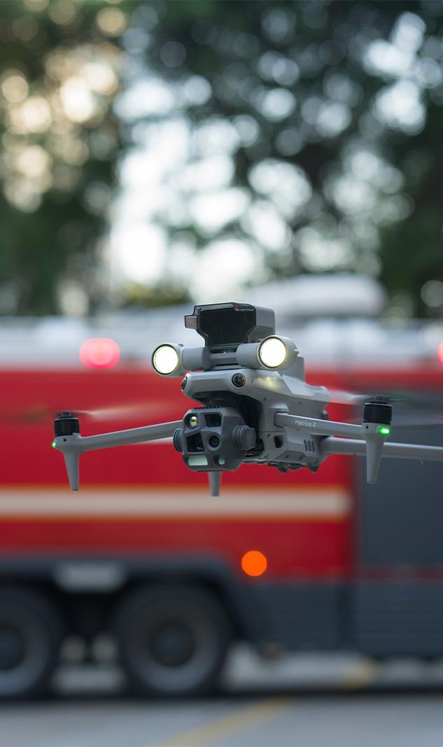
Hi-Res Thermal
High-resolution thermal sensor with Super Resolution Mode, 28x zoom, and -4°F to 1022°F range for critical operations.

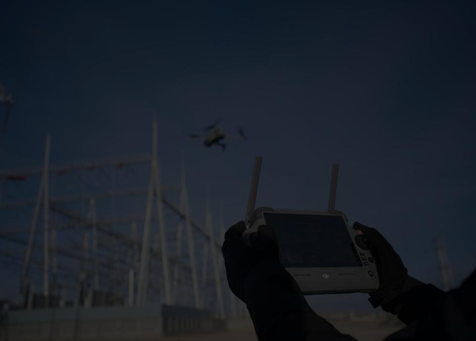
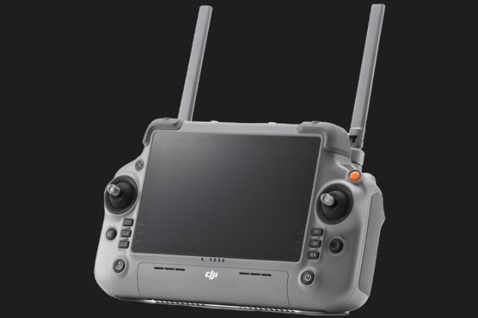
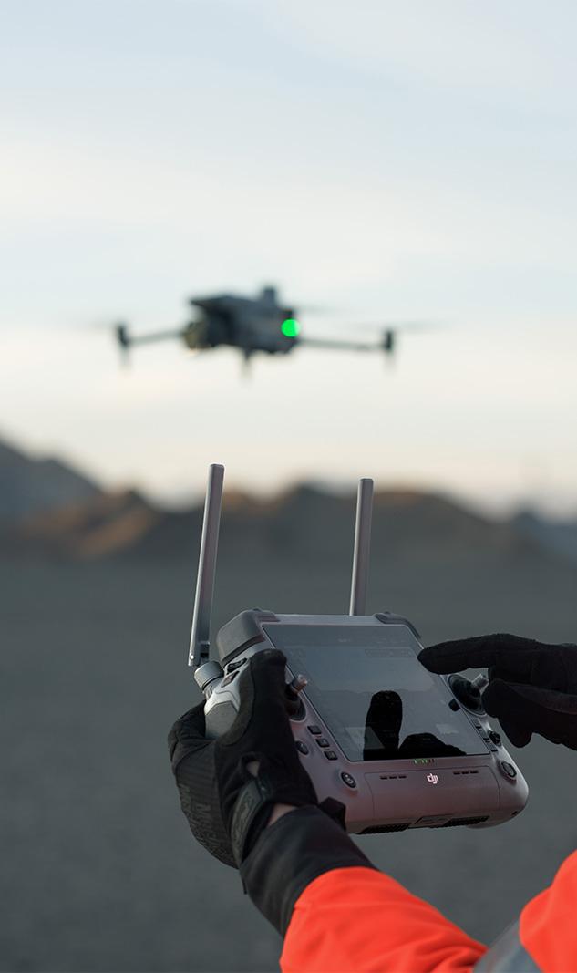
RC Plus 2
Next-gen DJI RC Plus 2 with 1400-nit display, 7-hour extended runtime, and advanced connectivity for professional control.

Laser Range Finder
Precision laser rangefinder measures up to 5,905 feet with ±0.7-foot accuracy, enhancing mapping and situational awareness.

Mechanical Shutter
4/3-inch CMOS 20MP sensor with a mechanical shutter, offering 0.5s capture intervals for precise mapping and surveying.

49-Minute Flight Time
Enhanced battery efficiency and optimized design deliver up to 49-minute flight times and a 21.7-mile range.

Obstacle Avoidance
Navigate complex environments confidently with the Matrice 4 Series’ omnidirectional binocular vision system and 3D infrared sensors.
Brand-New DJI RC Plus 2 Enterprise
The 7-inch 1400-nit ultra-bright touchscreen ensures crystal-clear visibility, even in direct sunlight, making it the ultimate professional-grade controller for demanding operations. With an extended runtime of up to 7 hours using the optional external battery, the DJI RC Plus 2 delivers uninterrupted performance.
Enhanced Connectivity: Dual-band Wi-Fi, HDMI output, and PD fast charging ensure seamless integration and quick recharge times for field operations.
Customizable Interface: Intuitive and adaptable UI to streamline workflows across various industries, from public safety to inspections.
Durable Design: Operates in extreme temperatures ranging from -4°F to 122°F, maintaining reliability in harsh environments.
Precision GNSS: Integrated GPS, Galileo, and BeiDou systems provide real-time dynamic positioning for accurate flight control.
Essential Software Ecosystem
DJI Pilot 2
DJI Pilot 2 simplifies mission planning with powerful tools for waypoint navigation, mapping, and oblique linear operations. Real-time 2D mapping directly on the controller enhances situational awareness, enabling operators to adapt on the fly. Designed for efficiency, it ensures seamless control and data integration across complex operations.
DJI FlightHub 2
DJI FlightHub 2 enables live mission streaming and real-time aircraft monitoring from any location. Collaborative mission planning becomes effortless with live updates to 2D maps and flight routes. It’s an essential tool for teams that need to stay connected and informed during critical operations.
DJI Thermal Analysis 3.0
The DJI Thermal Analysis Tool 3.0 lets operators analyze radiometric thermal data with precision. Create actionable reports to pinpoint heat sources, monitor temperature patterns, and track ignition history. It’s a vital resource for industries like firefighting, inspections, and energy management.
DJI Terra
DJI Terra transforms captured images into accurate 2D maps and detailed 3D models. This powerful software streamlines inspections, construction planning, and land surveys, providing precise data for better decision-making. It’s a reliable solution for professionals who demand accuracy and efficiency.
Matrice 4 Series: Tailored for Every Mission
Choosing the right drone is critical for mission success. The DJI Matrice 4T and 4E are engineered to meet the unique demands of enterprise operations. Whether you need high-precision thermal imaging or advanced mapping capabilities, there’s a Matrice model for your solution.
DJI Matrice 4 Enterprise
The Ultimate Mapping and Surveying Tool
- Wide Camera: 4/3-inch CMOS, 20 MP sensor with a mechanical shutter for distortion-free mapping.
- Photo Interval: Rapid 0.5s photo intervals for efficient data collection.
- Video Recording: 4K resolution at 30 frames per second.
- Zoom Capability: Medium telephoto and telephoto cameras with up to 16x optical zoom and 112x hybrid zoom for detailed mapping.
- Mapping Precision: Mechanical shutter ensures unmatched accuracy during high-speed aerial mapping.
- Smart 3D Capture: Real-time generation of mapping routes and 3D models on the controller.
DJI Matrice 4 Thermal
Precision for Public Safety, Inspections, and more
- Wide Camera: 1/1.3-inch CMOS, 48 MP sensor for sharp, high-resolution visuals.
- Medium Telephoto Camera: 1/1.3-inch CMOS, 48 MP with 70mm equivalent focal length for mid-range detail.
- Telephoto Camera: 1/1.5-inch CMOS, 48 MP with 168mm equivalent focal length for long-range precision.
- Thermal Imaging: 640x512 resolution, Super Resolution mode up to 1280x1024, and 28x digital zoom for heat detection.
- Video Recording: 4K resolution at 30 frames per second.
- Zoom Capability: 16x optical zoom; 112x hybrid zoom for unparalleled detail capture.
- Photo Interval: Minimum interval of 0.7s for rapid data acquisition.
Pick Your Purpose
Public Safety
Equip first responders with cutting-edge tools to enhance situational awareness and efficiency during critical missions.
- Thermal Imaging Excellence: The Matrice 4T’s uncooled VOx thermal sensor delivers high-resolution visuals (640x512 resolution, 1280x1024 in Super Resolution mode) for detecting heat signatures in low-visibility conditions.
- Laser Rangefinder: Accurately measure distances up to 5,905 feet (1,800 meters) to assess hazardous areas or locate individuals in complex environments.
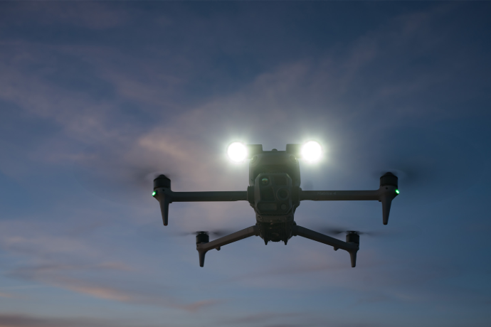
- NIR Auxiliary Lighting: Illuminate up to 328 feet (100 meters) in complete darkness, ideal for nighttime search-and-rescue operations.
- Real-Time Data Transmission: Pair with the DJI RC Plus 2 for live streaming and instant decision-making through DJI FlightHub 2.
- Accessories for Efficiency: The AS1 Speaker enables real-time broadcasting or recorded messages up to 984 feet (300 meters), ensuring communication in chaotic scenarios.
Precision Mapping & Surveying
Streamline workflows with the Matrice 4E’s advanced imaging capabilities and software tools tailored for accurate mapping.
- 4/3-Inch CMOS Camera: The wide-angle 20MP mechanical shutter ensures distortion-free aerial maps, critical for construction and land management projects.
- Rapid Photo Intervals: Capture images at 0.5-second intervals for efficient high-speed mapping of large areas.
- Smart 3D Capture: Generate detailed 3D models and mapping routes in real-time directly on the DJI RC Plus 2.
- Omnidirectional Safety: Navigate rugged terrains safely with the Matrice 4E’s obstacle sensing system, including omnidirectional binocular vision and 3D infrared sensors.
- Precision Flight: Operates with ±0.4-inch (1 cm) horizontal and ±0.6-inch (1.5 cm) vertical accuracy when paired with the RTK module for pinpoint data collection.

Industrial Inspections
Monitor critical infrastructure with unmatched detail and safety, reducing risks and improving operational uptime.
- Multi-Sensor Payload: The Matrice 4T’s wide-angle, medium telephoto, and telephoto cameras provide 48MP resolution, ensuring clear imagery of power lines, wind turbines, and pipelines.
- Thermal Imaging: Spot potential issues like overheating components with the high-resolution thermal sensor.
- Laser Rangefinder: Evaluate distances and dimensions with ±0.7-foot accuracy, ideal for large-scale assets like bridges or towers.
- Long Flight Durations: Cover extensive inspection routes with up to 49 minutes of flight time per battery.
- DJI Terra Integration: Transform captured data into 2D maps or 3D models for post-inspection analysis.
Energy Management
Enhance maintenance workflows and asset management for renewable energy sources and utility infrastructure.
- Thermal Sensor for Energy Audits: Use the Matrice 4T’s thermal imaging capabilities to identify faults in solar panels, pipelines, and substations.
- Wide-Area Surveys: The Matrice 4E’s high-speed capabilities (up to 47 mph) ensure efficient inspections of large wind or solar farms.
- Laser Rangefinder: Measure and map expansive sites accurately for maintenance planning.
- Smart Accessories: Add the AL1 Spotlight to illuminate components during low-light conditions or the AS1 Speaker for on-site communication with ground teams.
- Durable Design: Operates in temperatures ranging from 14°F to 104°F, ensuring reliability in harsh weather.
We're here when you need us.
Our Solutions Specialists are standing by to provide you with M4E Series pricing, schedule a demo, or just answer questions.
We use our experience as program managers and First Responders to help agencies like yours hone in on the perfect solution for your mission.
Industry Expertise. We take an experience-driven approach when it comes to guiding our customers toward the right solutions.
Low Pressure. Our entire sales process is low pressure from start to finish and tailored toward government purchasing to make sure you get the equipment you need, when you need it.
Diverse Product Catalog. We've spent almost an entire decade cultivating a diverse product catalog with solutions that solve real-world problems.
Unwavering Dedication. When we say nobody can support you the way UVT does, we mean it.