Utilities and Energy
Sustainable utility drone programs and solutions that improve safety, save money, and speed up field workflows.
Complete Utility Drone Solutions
UVT partners with utilities, co-ops, and energy operators to design and implement drone programs for transmission and distribution workflows, storm response, vegetation management, and asset documentation. Our team delivers end-to-end utility drone solutions, equipping your crews with the right aircraft and payloads, software, training, and long-term support needed to keep you moving forward.

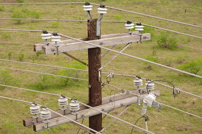
Transmission and Distribution Inspection
Capture high-resolution visual and thermal imagery of poles, structures, conductors, and components to support routine inspections, validation, and maintenance planning.
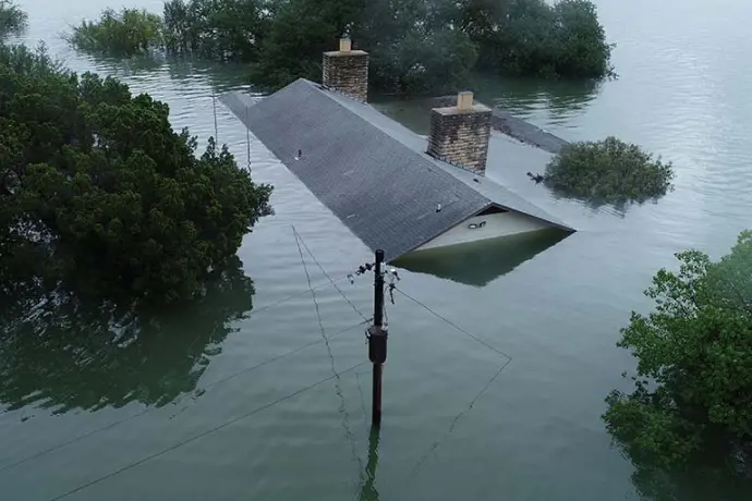
Storm Response and Damage Assessment
Rapid aerial damage surveys that help teams prioritize restoration work with clear documentation of impacted infrastructure and access constraints.
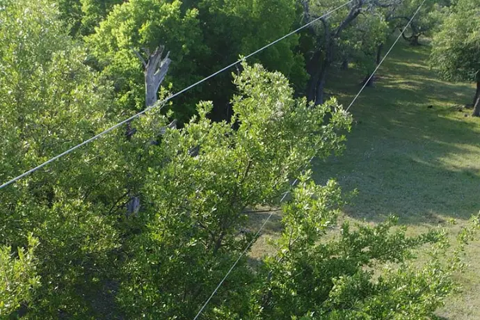
Vegetation Management and ROW Inspection
Corridor awareness for vegetation encroachment and right-of-way monitoring using imagery, thermal, and LiDAR based on the deliverables your team needs.
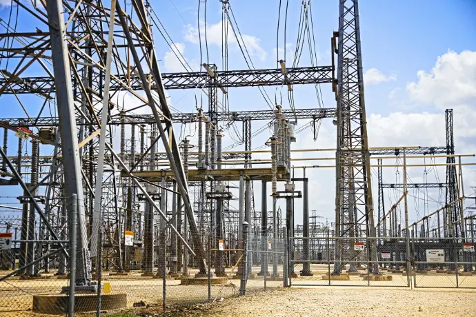
Substation and Switchyard Inspection
Aerial visibility for asset documentation and inspection workflows where access, safety, and time on site matter.
Proven Energy Drone Solutions
160,000+ miles of line inspected through UVT utility drone solutions.
The Benefits of Drones in Utilities & Energy
Our intelligent Utility drone programs do more than just capture data and images.
Safer, faster power line inspections.
Drones enable line crews to quickly get a complete view of any structure to assess damage, validate repairs and perform a variety of other inspections without unnecessary exposure. Our quick-deploy utility drones are designed to live in your trucks and serve as the first set of eyes during any outage or call for service.
Automated asset management, you can use.
Build an inspection record that supports mapping, documentation, and maintenance decision-making with high-resolution visual imagery, thermal, LiDAR, and geolocation. Every image captured by the drone will contain millions of pixels and highly accurate data that can be turned into a real-time map of your entire infrastructure.
Right-of-way visibility for vegetation management
High-resolution visual and thermal imagery alone is more than capable of giving you a good understanding of the current state of vegetation along your ROW. Combine visual, thermal, multispectral, and LiDAR options to understand vegetation condition and clearance risk across corridors and prioritize work.
Consider This When Building a Utility Drone Program...
We've been equipping utilities and cooperatives with drones since 2014. We use that experience to equip your team with key considerations when starting or scaling a utility drone program.
Budget
Deliverables
In utilities, deliverables often start with high-resolution imagery for asset visibility, then expand into thermal, LiDAR, multispectral, and corona workflows depending on the mission. Define the output first, then everything downstream becomes easier.
Hardware
Payload drives the mission. Match sensors to the data you need, then choose the platform that can carry them reliably in your operating conditions. Plan on multiple tools for multiple jobs. One drone will not do everything, and you will save money by designing the fleet with purpose.
The drone captures data. Software turns it into something usable. Utilities need mapping, documentation, visualization, and structure records that teams can access and act on. The right software package keeps the program moving and prevents your field teams from becoming accidental data engineers.
We don't move boxes. We set up robust, efficient, scalable drone programs for utilities and cooperatives nationwide.
A utility drone program needs a five-year view. Standards, training, support, and repeatable workflows determine whether you can expand across regions, crews, and storm seasons without breaking the model. UVT is built to support that kind of long-term execution.
Try to avoid the hype. It's mostly noise.
Budgeting is simpler when you start with the workflow and deliverables. Hardware changes fast. Licensing and enablement costs can be the part that surprises teams later, especially when critical capabilities are gated behind add-ons.
Hidden fees can turn “pay to play” into “pay to work.” We help utilities surface those costs early so budgets match reality.
Drones are powerful data collection tools...but they're still just a tool.
Step aside, drone. The payload reigns supreme.
The key to your drone's full potential.
Software
Scalability
We're here when you need us.
Our Solutions Specialists are standing by to provide you with a price quote, schedule an on-site demo, or just answer questions.
We use over 30 years of combined experience to help organizations like yours hone in on the perfect solution for the job.
Industry Expertise. We take an experience-driven approach when it comes to guiding our customers toward the right solutions.
Low Pressure. Our entire sales process is low pressure from start to finish and tailored toward government purchasing to make sure you get the equipment you need, when you need it.
Diverse Product Catalog. We've spent almost an entire decade cultivating a diverse product catalog with solutions that solve real world problems.
Unwavering Dedication. When we say nobody can support you the way UVT does, we mean it.